|
At the Edge
- Click the image above for a larger view
- Full-Res JPEG (1172 x 2575) (129.5 kB)
- Full-Res TIFF (1172 x 2575) (1.9 MB)
Caption:
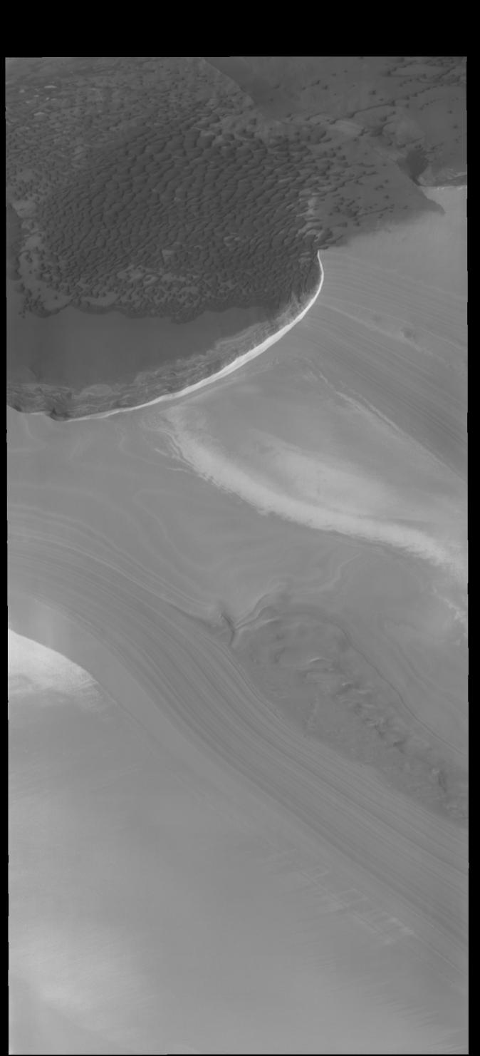
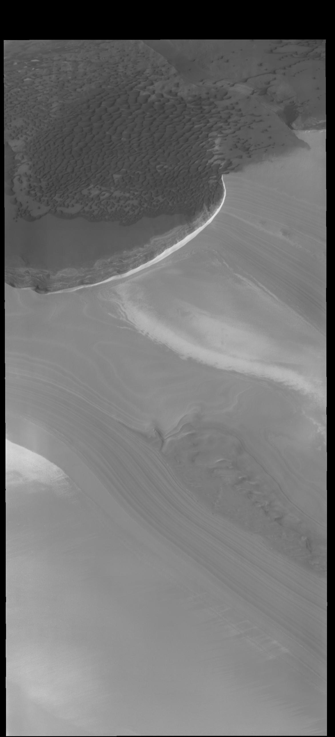
Context image
Today's VIS image is located along the edge of the north polar cap. The ice of the cap covers most of the image, with only the upper 1/4 of the image showing the ice free plains. Dunes cover most of the plains and are 'climbing' up onto the cap. This region of dunes in near Olympia Undae, the immense sand sea that surrounds part of the polar cap.
Orbit Number: 80094 Latitude: 83.6465 Longitude: 118.114 Instrument: VIS Captured: 2020-01-04 06:40
Background Info:
Please see the THEMIS Data Citation Note for details on crediting THEMIS images.
NASA's Jet Propulsion Laboratory manages the 2001 Mars Odyssey mission for NASA's Science Mission Directorate, Washington, D.C. The Thermal Emission Imaging System (THEMIS) was developed by Arizona State University, Tempe, in collaboration with Raytheon Santa Barbara Remote Sensing. The THEMIS investigation is led by Dr. Philip Christensen at Arizona State University. Lockheed Martin Astronautics, Denver, is the prime contractor for the Odyssey project, and developed and built the orbiter. Mission operations are conducted jointly from Lockheed Martin and from JPL, a division of the California Institute of Technology in Pasadena.
Cataloging Keywords:
| Name | Value | Additional Values |
|---|---|---|
| Target | Mars | |
| System | ||
| Target Type | Planet | |
| Mission | 2001 Mars Odyssey | |
| Instrument Host | Mars Odyssey | |
| Host Type | Orbiter | |
| Instrument | Thermal Emission Imaging System (THEMIS) | |
| Detector | ||
| Extra Keywords | Dune, Grayscale, Thermal | |
| Acquisition Date | ||
| Release Date | 2020-03-17 | |
| Date in Caption | 2020-01-04 | |
| Image Credit | NASA/JPL-Caltech/ASU | |
| Source | photojournal.jpl.nasa.gov/catalog/PIA23752 | |
| Identifier | PIA23752 | |