|
Disrupted Sediments in Acidalia Planitia
- Click the image above for a larger view
- Full-Res JPEG (2880 x 1800) (1.0 MB)
- Full-Res TIFF (2880 x 1800) (15.6 MB)
Caption:
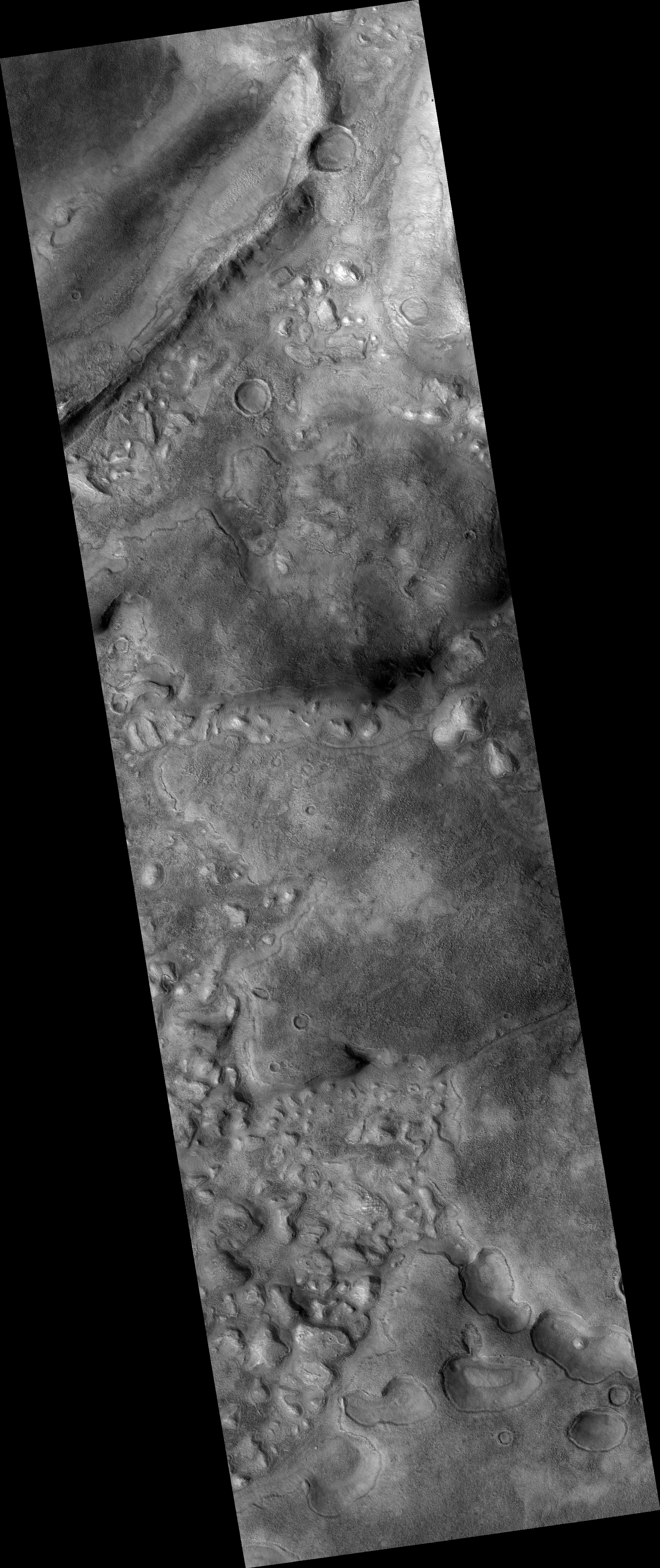
Map Projected Browse Image
Click on image for larger version
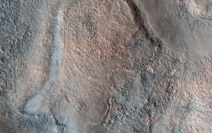
This color HiRISE view shows a pitted, blocky surface, but also more unusually, it has contorted, irregular features.
Although there are impact craters in this area, some of the features ( like in the lower center of the cutout ) are too irregular to be relic impact craters or river channels. One possibility is that sedimentary layers have been warped from below to create these patterns. The freezing and thawing of subsurface ice is a mechanism that could have caused this.
Acidalia Planitia is part of the northern plains of Mars, at a latitude of 44 degrees north.
The map is projected here at a scale of 50 centimeters (19.7 inches) per pixel. (The original image scale is 63.7 centimeters [25.1 inches] per pixel [with 2 x 2 binning]; objects on the order of 191 centimeters [75.2 inches] across are resolved.) North is up.
Background Info:
The University of Arizona, in Tucson, operates HiRISE, which was built by Ball Aerospace & Technologies Corp., in Boulder, Colorado. NASA's Jet Propulsion Laboratory, a division of Caltech in Pasadena, California, manages the Mars Reconnaissance Orbiter Project for NASA's Science Mission Directorate, Washington.
Cataloging Keywords:
| Name | Value | Additional Values |
|---|---|---|
| Target | Mars | |
| System | ||
| Target Type | Planet | |
| Mission | Mars Reconnaissance Orbiter (MRO) | |
| Instrument Host | Mars Reconnaissance Orbiter | |
| Host Type | Orbiter | |
| Instrument | High Resolution Imaging Science Experiment (HiRISE) | |
| Detector | ||
| Extra Keywords | Color, Crater, Impact, Map | |
| Acquisition Date | ||
| Release Date | 2020-04-17 | |
| Date in Caption | ||
| Image Credit | NASA/JPL-Caltech/University of Arizona | |
| Source | photojournal.jpl.nasa.gov/catalog/PIA23855 | |
| Identifier | PIA23855 | |