|
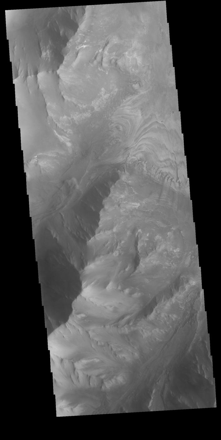
Melas Chasma
- Click the image above for a larger view
- Full-Res JPEG (1334 x 2653) (183.5 kB)
- Full-Res TIFF (1334 x 2653) (2.2 MB)
Caption:

Context image
This VIS image shows part of the southern cliffside of Melas Chasma. Melas Chasma is part of the largest canyon system on Mars, Valles Marineris. At only 563 km long (349 miles) it is not the longest canyon, but it is the widest. Located in the center of Valles Marineris, it has depths up to 9 km below the surrounding plains, and is the location of many large landslide deposits, as will as layered materials and sand dunes. There is evidence of both water and wind action as modes of formation for many of the interior deposits.
Orbit Number: 81537 Latitude: -11.3482 Longitude: 284.901 Instrument: VIS Captured: 2020-05-02 01:42
Background Info:
Please see the THEMIS Data Citation Note for details on crediting THEMIS images.
NASA's Jet Propulsion Laboratory manages the 2001 Mars Odyssey mission for NASA's Science Mission Directorate, Washington, D.C. The Thermal Emission Imaging System (THEMIS) was developed by Arizona State University, Tempe, in collaboration with Raytheon Santa Barbara Remote Sensing. The THEMIS investigation is led by Dr. Philip Christensen at Arizona State University. Lockheed Martin Astronautics, Denver, is the prime contractor for the Odyssey project, and developed and built the orbiter. Mission operations are conducted jointly from Lockheed Martin and from JPL, a division of the California Institute of Technology in Pasadena.
Cataloging Keywords:
| Name | Value | Additional Values |
|---|---|---|
| Target | Mars | |
| System | ||
| Target Type | Planet | |
| Mission | 2001 Mars Odyssey | Mariner |
| Instrument Host | Mars Odyssey | |
| Host Type | Orbiter | Flyby Spacecraft |
| Instrument | Thermal Emission Imaging System (THEMIS) | |
| Detector | ||
| Extra Keywords | Dune, Grayscale, Thermal, Water | |
| Acquisition Date | ||
| Release Date | 2020-06-30 | |
| Date in Caption | 2020-05-02 | |
| Image Credit | NASA/JPL-Caltech/ASU | |
| Source | photojournal.jpl.nasa.gov/catalog/PIA23992 | |
| Identifier | PIA23992 | |