|
A Criss-Cross Landscape with Fresh Craters
- Click the image above for a larger view
- Full-Res JPEG (2880 x 1800) (1.1 MB)
- Full-Res TIFF (2880 x 1800) (15.5 MB)
Caption:
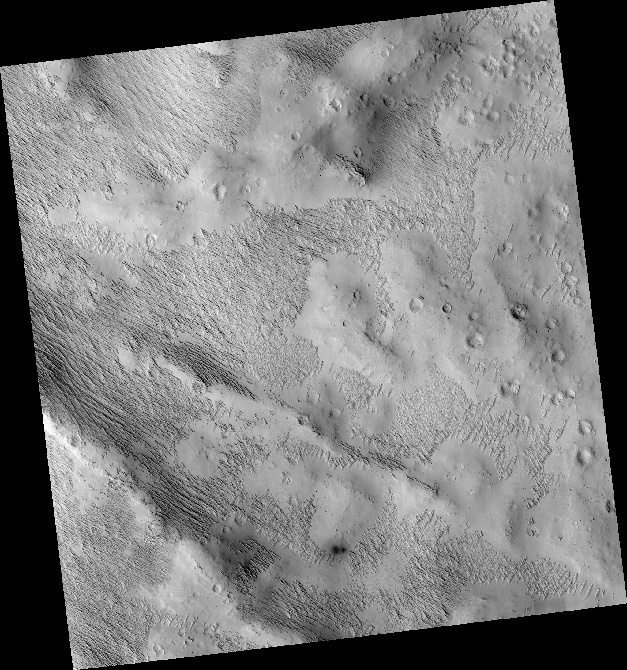
Map Projected Browse Image
Click on image for larger version
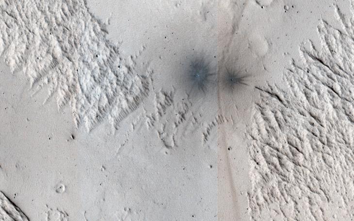
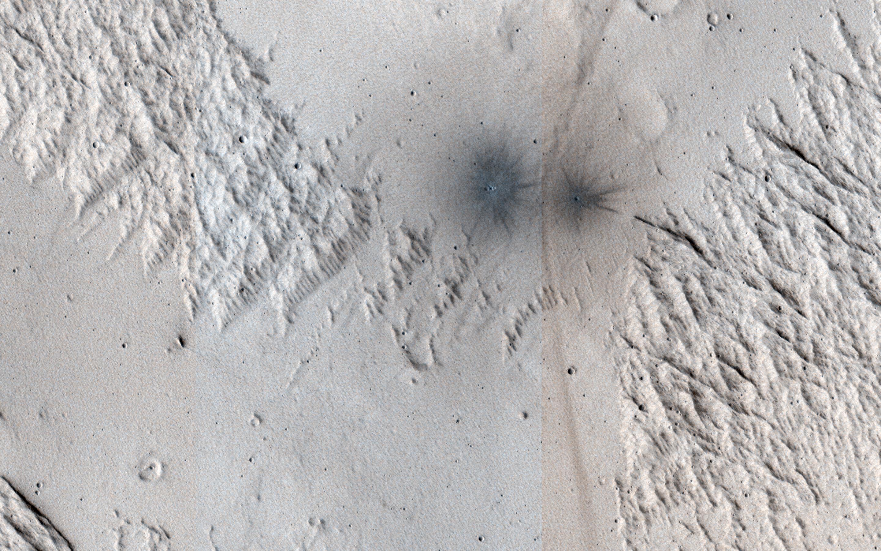
This image shows terrain near Mangala Valles. At the bottom of the image are two black spots that are recent impact craters.
The black spots form because the craters exposed cleaner materials in the subsurface beneath the bright, dusty surface. Our image is also interesting because the surface has a criss-cross pattern formed by wind activity. Bright ripples that are oriented from the upper right to the lower left are perpendicular to the wind flow.
In contrast, outcrops that have been eroded by the wind are oriented perpendicular to the ripples to produce the criss-cross pattern we now observe.
The map is projected here at a scale of 25 centimeters (9.8 inches) per pixel. (The original image scale is 26.5 centimeters [10.4 inches] per pixel [with 1 x 1 binning]; objects on the order of 79 centimeters [31.1 inches] across are resolved.) North is up.
Background Info:
The University of Arizona, in Tucson, operates HiRISE, which was built by Ball Aerospace & Technologies Corp., in Boulder, Colorado. NASA's Jet Propulsion Laboratory, a division of Caltech in Pasadena, California, manages the Mars Reconnaissance Orbiter Project for NASA's Science Mission Directorate, Washington.
Cataloging Keywords:
| Name | Value | Additional Values |
|---|---|---|
| Target | Moon | Mars |
| System | Earth | Mars |
| Target Type | Satellite | Planet |
| Mission | Mars Reconnaissance Orbiter (MRO) | |
| Instrument Host | Mars Reconnaissance Orbiter | |
| Host Type | Orbiter | |
| Instrument | High Resolution Imaging Science Experiment (HiRISE) | |
| Detector | ||
| Extra Keywords | Color, Crater, Dust, Impact, Map | |
| Acquisition Date | ||
| Release Date | 2020-10-12 | |
| Date in Caption | ||
| Image Credit | NASA/JPL-Caltech/University of Arizona | |
| Source | photojournal.jpl.nasa.gov/catalog/PIA24146 | |
| Identifier | PIA24146 | |