|
Pit Craters and Giant Volcanoes
- Click the image above for a larger view
- Full-Res JPEG (2880 x 1800) (852.1 kB)
- Full-Res TIFF (2880 x 1800) (13.7 MB)
Caption:

Map Projected Browse Image
Click on image for larger version
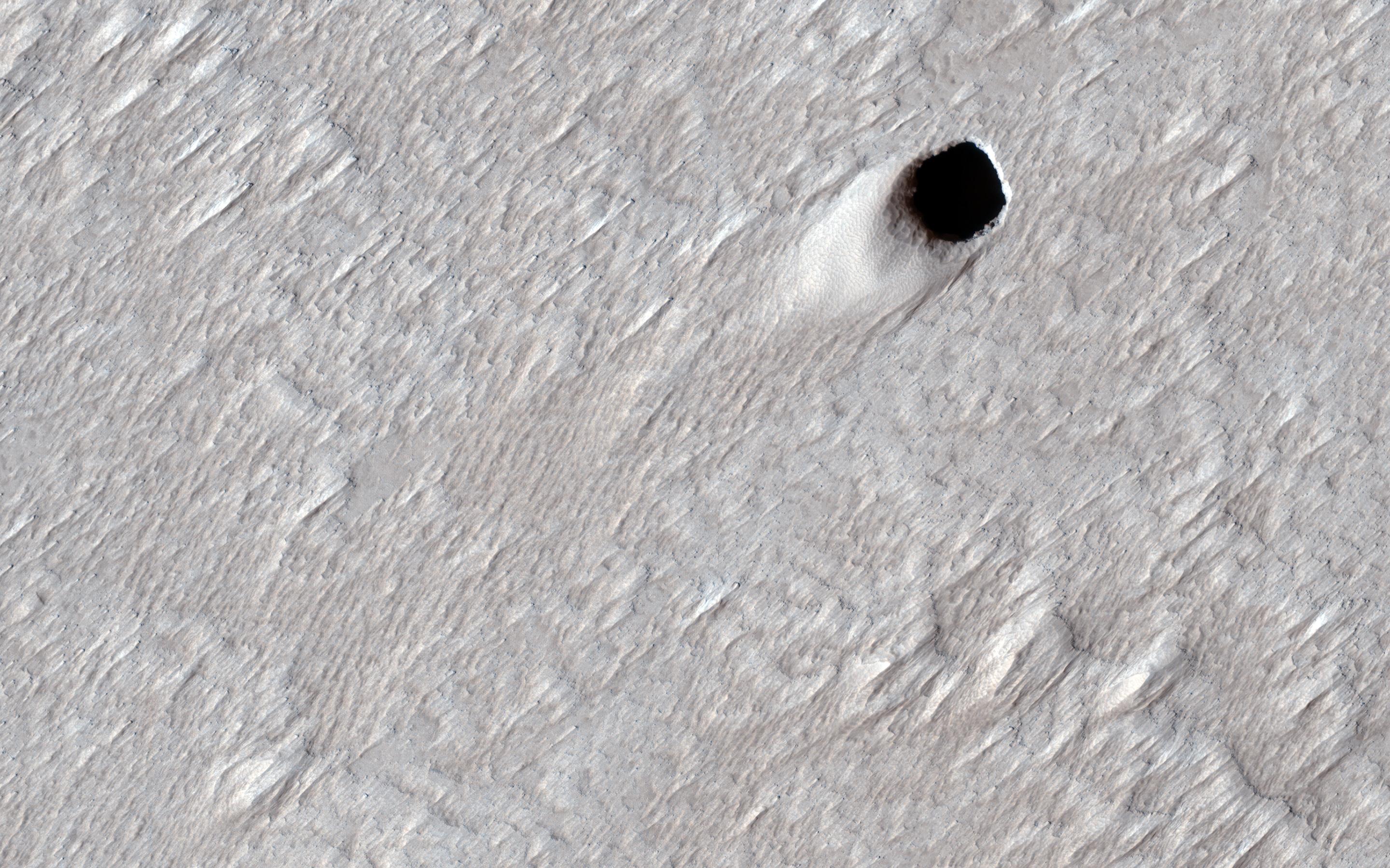
Some types of lava can squeeze underneath older rock and lift it up so it can continue to flow underground. Large underground rivers of lava can form this way and when the volcano stops erupting, the lava can drain out of these underground tubes. These empty underground tubes are common on the Earth and may criss-cross the giant volcanoes of Mars like in this location on the flanks of Arsia Mons.
In this image, the ceiling of the lava tube collapsed in one spot and made this pit crater . The pit is about 50 meters (150 feet) across, so it's likely that the underground tube is also at least this big (much bigger than similar caves on the Earth). HiRISE can't see inside these steep pits because it's always late afternoon when we pass overhead and the inside is shadowed at that time of day.
The map is projected here at a scale of 25 centimeters (9.8 inches) per pixel. (The original image scale is 25.1 centimeters [9.8 inches] per pixel [with 1 x 1 binning]; objects on the order of 75 centimeters [29.5 inches] across are resolved.) North is up.
Background Info:
The University of Arizona, in Tucson, operates HiRISE, which was built by Ball Aerospace & Technologies Corp., in Boulder, Colorado. NASA's Jet Propulsion Laboratory, a division of Caltech in Pasadena, California, manages the Mars Reconnaissance Orbiter Project for NASA's Science Mission Directorate, Washington.
Cataloging Keywords:
| Name | Value | Additional Values |
|---|---|---|
| Target | Mars | |
| System | ||
| Target Type | Planet | |
| Mission | Mars Reconnaissance Orbiter (MRO) | |
| Instrument Host | Mars Reconnaissance Orbiter | |
| Host Type | Orbiter | |
| Instrument | High Resolution Imaging Science Experiment (HiRISE) | |
| Detector | ||
| Extra Keywords | Color, Crater, Map, Mountain, Shadow, Volcano | |
| Acquisition Date | ||
| Release Date | 2020-10-12 | |
| Date in Caption | ||
| Image Credit | NASA/JPL-Caltech/University of Arizona | |
| Source | photojournal.jpl.nasa.gov/catalog/PIA24149 | |
| Identifier | PIA24149 | |
