|
South Polar Cap Terrain
- Click the image above for a larger view
- Full-Res JPEG (2880 x 1800) (626.3 kB)
- Full-Res TIFF (2880 x 1800) (13.7 MB)
Caption:

Map Projected Browse Image
Click on image for larger version
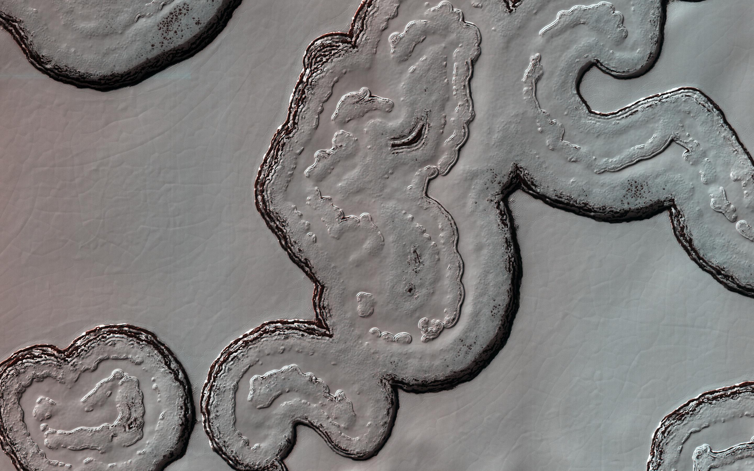
This intriguing, almost cartoon-like terrain is composed of coalescing pits and smooth-topped mesas, forming part of what is known as the Residual South Polar Cap (RSPC) of Mars.
The RSPC is a permanent deposit of carbon dioxide (dry) ice that is several kilometers thick and overlies a much larger water ice cap. This part of the RSPC lies at an elevation of about 6.5 kilometers. The mesas are several kilometers long while the pits range in diameter up to several hundred meters. The dark regions surrounding the mesas are thought to be exposed water ice.
This image was taken during southern summer when the brighter-appearing dry ice cap sublimates (evaporates directly from ice to vapor) exposing the darker, underlying water ice cap. Understanding the seasonal and yearly volumes of carbon dioxide exchange between the surface and the atmosphere provides important insights into Mars' climate.
The map is projected here at a scale of 25 centimeters (9.8 inches) per pixel. (The original image scale is 24.6 centimeters [9.7 inches] per pixel [with 1 x 1 binning]; objects on the order of 74 centimeters [29.1 inches] across are resolved.) North is up.
Background Info:
The University of Arizona, in Tucson, operates HiRISE, which was built by Ball Aerospace & Technologies Corp., in Boulder, Colorado. NASA's Jet Propulsion Laboratory, a division of Caltech in Pasadena, California, manages the Mars Reconnaissance Orbiter Project for NASA's Science Mission Directorate, Washington.
Cataloging Keywords:
| Name | Value | Additional Values |
|---|---|---|
| Target | Mars | |
| System | ||
| Target Type | Planet | |
| Mission | Mars Reconnaissance Orbiter (MRO) | |
| Instrument Host | Mars Reconnaissance Orbiter | |
| Host Type | Orbiter | |
| Instrument | High Resolution Imaging Science Experiment (HiRISE) | |
| Detector | ||
| Extra Keywords | Atmosphere, Color, Map, Water | |
| Acquisition Date | ||
| Release Date | 2021-02-26 | |
| Date in Caption | ||
| Image Credit | NASA/JPL-Caltech/University of Arizona | |
| Source | photojournal.jpl.nasa.gov/catalog/PIA24463 | |
| Identifier | PIA24463 | |
