
|
Collapse Pit
- Click the image above for a larger view
- Full-Res JPEG (2880 x 1800) (1.2 MB)
- Full-Res TIFF (2880 x 1800) (15.6 MB)
Caption:

Map Projected Browse Image
Click on image for larger version
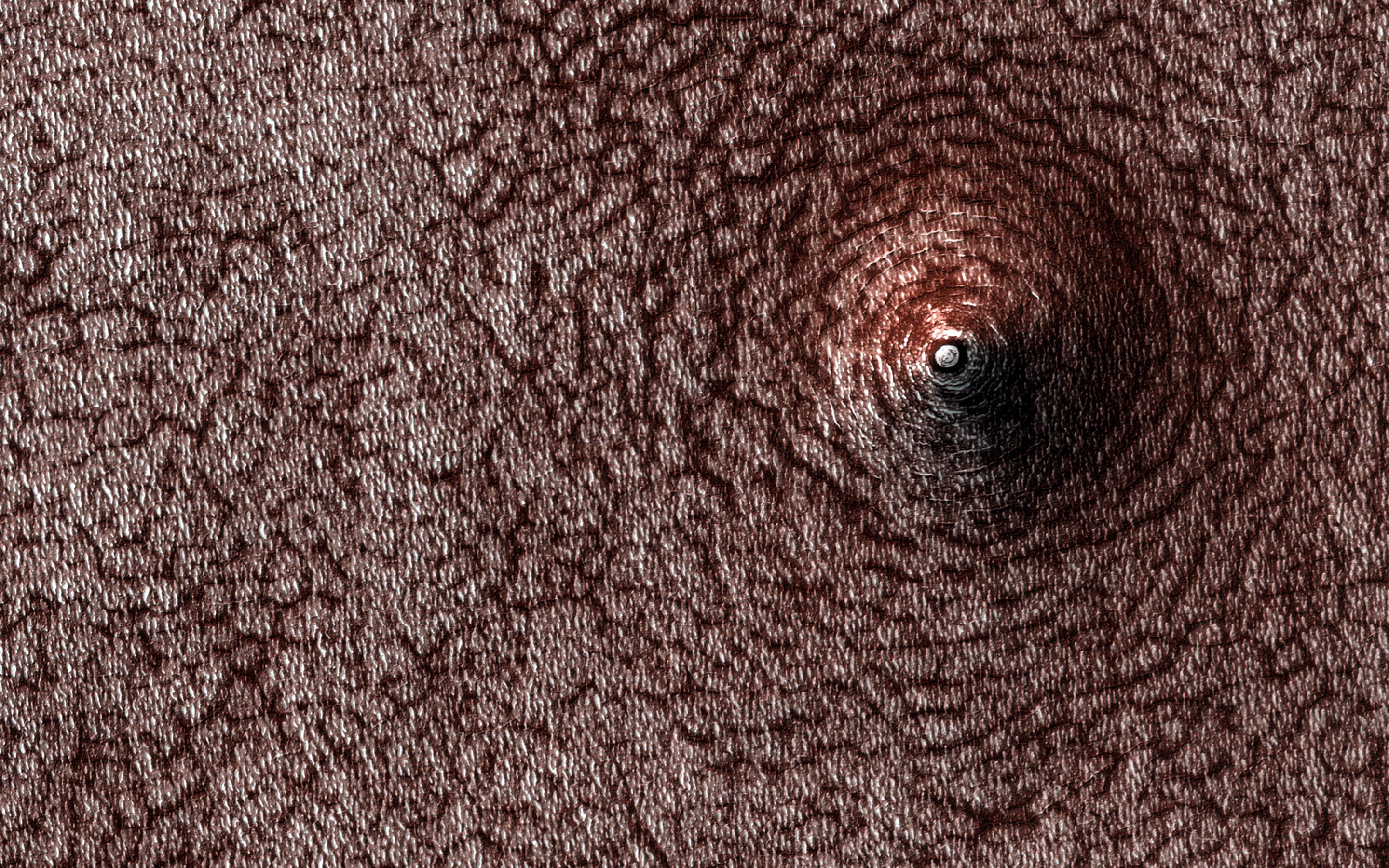
Do you see a dome or a pit? Sometimes it is hard to tell! In this case, the answer is that we're looking at a pit, if the title didn't already give it away.
Levity aside, we can tell this is a pit because we know what direction the sunlight is coming from and which side should be in shadow. This pit has formed on the south polar layered deposits . Why did it collapse? That is the real question to be answered.
The map is projected here at a scale of 50 centimeters (19.7 inches) per pixel. (The original image scale is 49.6 centimeters [19.5 inches] per pixel [with 2 x 2 binning]; objects on the order of 149 centimeters [58.7 inches] across are resolved.) North is up.
Background Info:
The University of Arizona, in Tucson, operates HiRISE, which was built by Ball Aerospace & Technologies Corp., in Boulder, Colorado. NASA's Jet Propulsion Laboratory, a division of Caltech in Pasadena, California, manages the Mars Reconnaissance Orbiter Project for NASA's Science Mission Directorate, Washington.
Cataloging Keywords:
| Name | Value | Additional Values |
|---|---|---|
| Target | Mars | |
| System | ||
| Target Type | Planet | |
| Mission | Mars Reconnaissance Orbiter (MRO) | |
| Instrument Host | Mars Reconnaissance Orbiter | |
| Host Type | Orbiter | |
| Instrument | High Resolution Imaging Science Experiment (HiRISE) | |
| Detector | ||
| Extra Keywords | Color, Map, Shadow | |
| Acquisition Date | ||
| Release Date | 2021-04-27 | |
| Date in Caption | ||
| Image Credit | NASA/JPL-Caltech/University of Arizona | |
| Source | photojournal.jpl.nasa.gov/catalog/PIA24614 | |
| Identifier | PIA24614 | |