|
Seasonal Changes of Polar Megadunes
- Click the image above for a larger view
- Full-Res JPEG (2880 x 1800) (746.8 kB)
- Full-Res TIFF (2880 x 1800) (15.6 MB)
Caption:
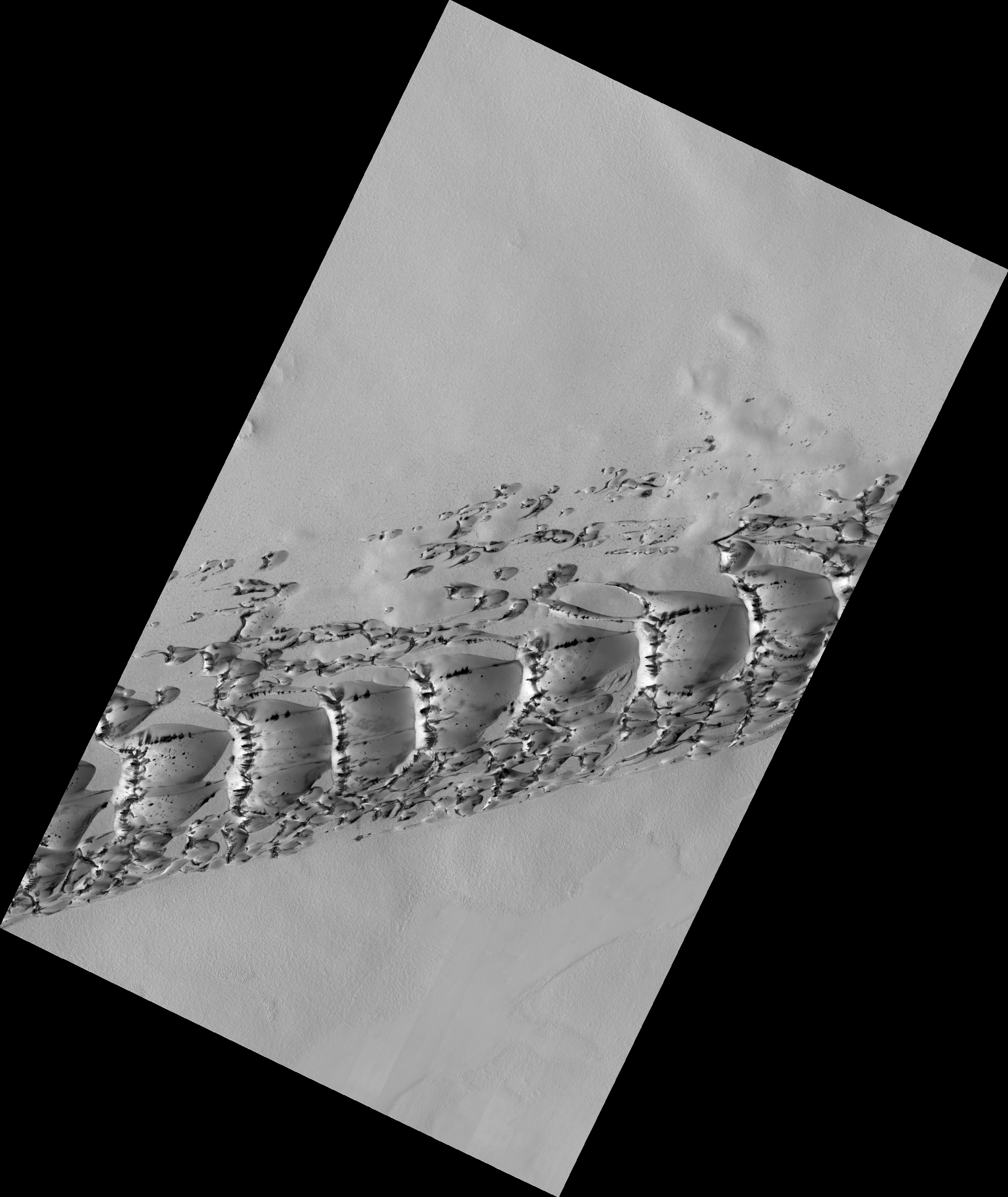
Map Projected Browse Image
Click on image for larger version
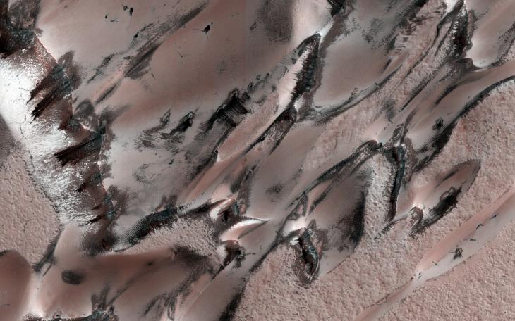
This image covers a unique polar dune field during northern spring, revealing some interesting patterns.
The main "megadune" formation comprises giant crescent-shaped dunes called "barchans," which have been migrating ( from upper-right to lower-left ) over the past several centuries or more.
Light-toned seasonal carbon dioxide frost and ice that accumulated over the winter still covers the majority of the surface, and is now starting to defrost and sublimate in complex patterns . (This depends on the slope aspect and incoming solar illumination). As frost is removed, the darker "coal-black" nature of the dune sand is revealed. For example, compare with this image taken in summer , when frost is gone and the dunes are migrating.
The striped patterns of the carbon dioxide frost and linear nature of the dune field give it a sea serpent-like appearance.
The map is projected here at a scale of 25 centimeters (9.8 inches) per pixel. (The original image scale is 31.8 centimeters [12.5 inches] per pixel [with 1 x 1 binning]; objects on the order of 95 centimeters [37.4 inches] across are resolved.) North is up.
Background Info:
The University of Arizona, in Tucson, operates HiRISE, which was built by Ball Aerospace & Technologies Corp., in Boulder, Colorado. NASA's Jet Propulsion Laboratory, a division of Caltech in Pasadena, California, manages the Mars Reconnaissance Orbiter Project for NASA's Science Mission Directorate, Washington.
Cataloging Keywords:
| Name | Value | Additional Values |
|---|---|---|
| Target | Mars | |
| System | ||
| Target Type | Planet | |
| Mission | Mars Reconnaissance Orbiter (MRO) | |
| Instrument Host | Mars Reconnaissance Orbiter | |
| Host Type | Orbiter | |
| Instrument | High Resolution Imaging Science Experiment (HiRISE) | |
| Detector | ||
| Extra Keywords | Color, Dune, Map | |
| Acquisition Date | ||
| Release Date | 2021-07-28 | |
| Date in Caption | ||
| Image Credit | NASA/JPL-Caltech/University of Arizona | |
| Source | photojournal.jpl.nasa.gov/catalog/PIA24699 | |
| Identifier | PIA24699 | |