
|
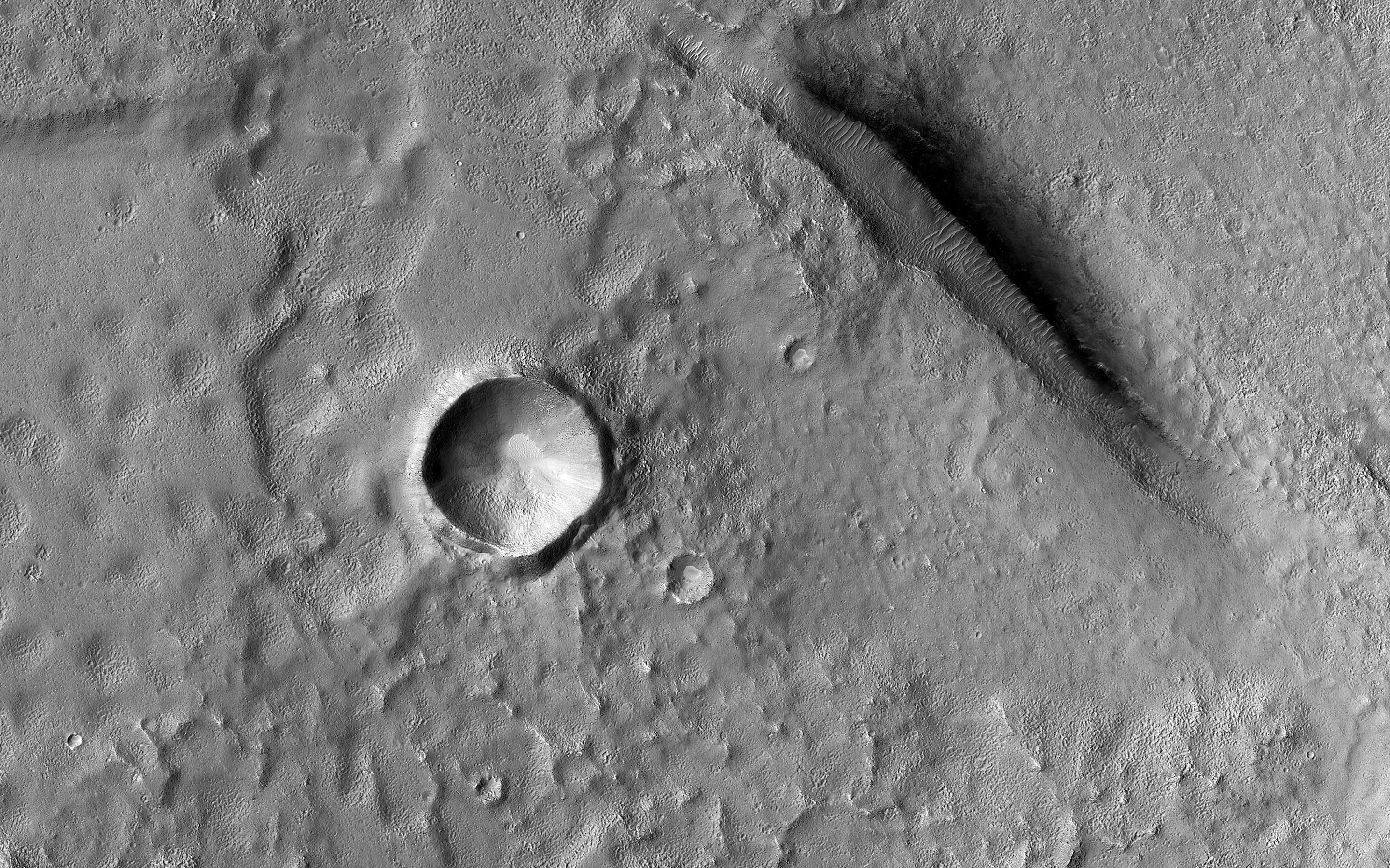
Utopia Planitia
- Click the image above for a larger view
- Full-Res JPEG (2880 x 1800) (1.3 MB)
- Full-Res TIFF (2880 x 1800) (5.2 MB)
Caption:
Map Projected Browse Image
Click on image for larger version
The Utopia Planitia region contains many distinctive landscapes. The bumpy and pitted ground in this image may have formed through the eruption of either lava or mud onto the surface from deep underground.
Mud volcanoes on Earth provide oases for life. If these features also formed through the eruption of mud, these landforms may hold clues to possible life-supporting oases in Mars' distant past.
The map is projected here at a scale of 50 centimeters (19.7 inches) per pixel. (The original image scale is 58.8 centimeters [23.1 inches] per pixel [with 2 x 2 binning]; objects on the order of 177 centimeters [69.7 inches] across are resolved.) North is up.
Background Info:
The University of Arizona, in Tucson, operates HiRISE, which was built by Ball Aerospace & Technologies Corp., in Boulder, Colorado. NASA's Jet Propulsion Laboratory, a division of Caltech in Pasadena, California, manages the Mars Reconnaissance Orbiter Project for NASA's Science Mission Directorate, Washington.
Cataloging Keywords:
| Name | Value | Additional Values |
|---|---|---|
| Target | Mars | |
| System | ||
| Target Type | Planet | |
| Mission | Mars Reconnaissance Orbiter (MRO) | |
| Instrument Host | Mars Reconnaissance Orbiter | |
| Host Type | Orbiter | |
| Instrument | High Resolution Imaging Science Experiment (HiRISE) | |
| Detector | ||
| Extra Keywords | Color, Map, Volcano | |
| Acquisition Date | ||
| Release Date | 2021-10-19 | |
| Date in Caption | ||
| Image Credit | NASA/JPL-Caltech/University of Arizona | |
| Source | photojournal.jpl.nasa.gov/catalog/PIA24917 | |
| Identifier | PIA24917 | |