|
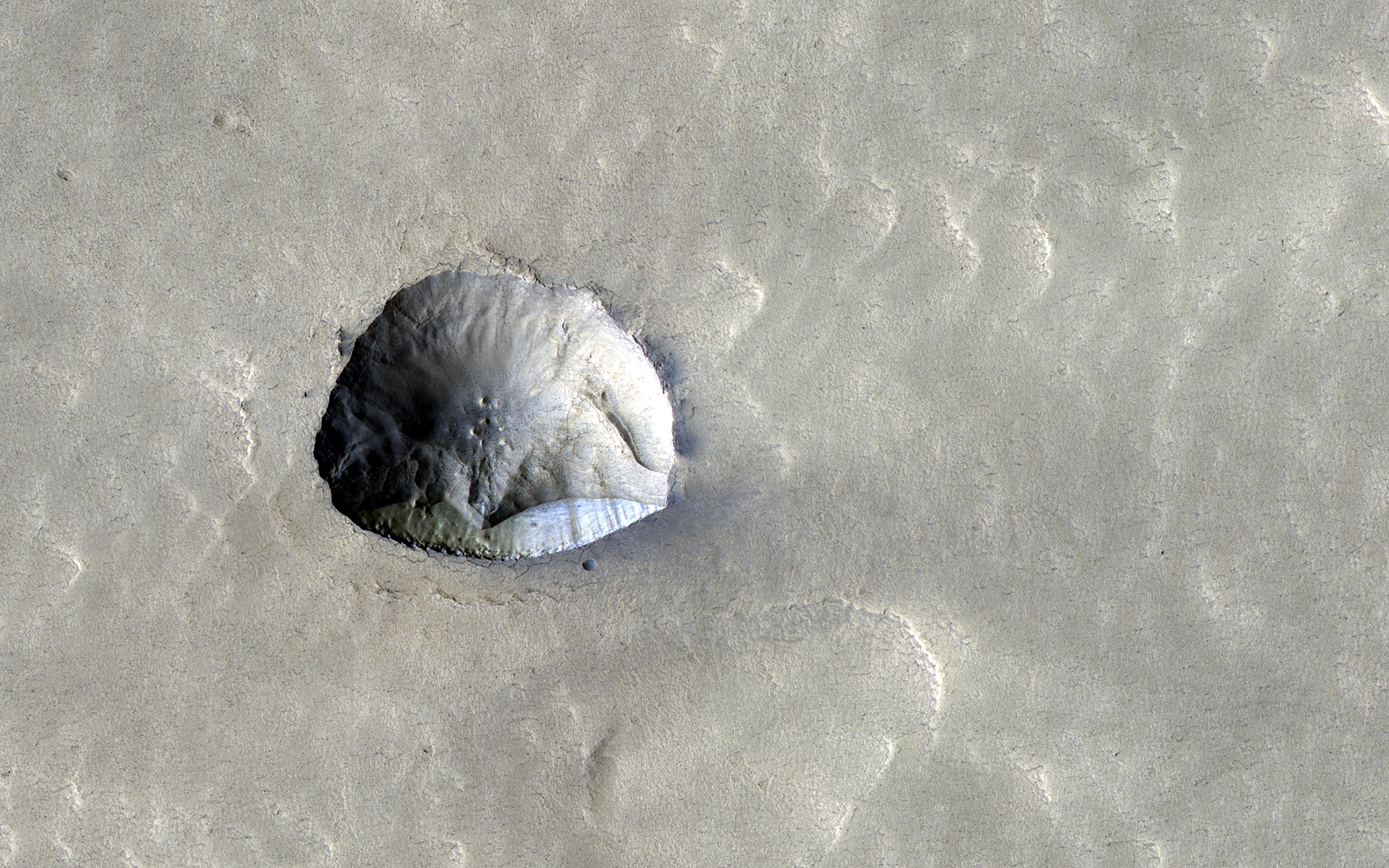
Icy Cliffs and Impact Craters
- Click the image above for a larger view
- Full-Res JPEG (2880 x 1800) (918.0 kB)
- Full-Res TIFF (2880 x 1800) (15.3 MB)
Caption:

Map Projected Browse Image
Click on image for larger version
We've come to understand in recent years that about a third of Mars has ice just below the surface. Many impact craters in the mid-latitudes are filled with smooth material that is probably ice covered with a little dirt. Part of one of these filled craters appears in this HiRISE image and has an interesting feature about 250 meters (800 feet) across, near the image center.
What looks like might have been a small impact crater now has a straight edge with a steep cliff on its southern side . This north-facing cliff appears to expose icy material that's similar to other pole-facing scarps showing buried ice elsewhere on the planet. These cliffs give us a cut-away view of the buried ice in that location and can help answer questions about what the Martian climate was like when this ice formed.
The map is projected here at a scale of 50 centimeters (19.7 inches) per pixel. (The original image scale is 60.4 centimeters [23.8 inches] per pixel [with 2 x 2 binning]; objects on the order of 181 centimeters [71.3 inches] across are resolved.) North is up.
Background Info:
The University of Arizona, in Tucson, operates HiRISE, which was built by Ball Aerospace & Technologies Corp., in Boulder, Colorado. NASA's Jet Propulsion Laboratory, a division of Caltech in Pasadena, California, manages the Mars Reconnaissance Orbiter Project for NASA's Science Mission Directorate, Washington.
Cataloging Keywords:
| Name | Value | Additional Values |
|---|---|---|
| Target | Mars | |
| System | ||
| Target Type | Planet | |
| Mission | Mars Reconnaissance Orbiter (MRO) | |
| Instrument Host | Mars Reconnaissance Orbiter | |
| Host Type | Orbiter | |
| Instrument | High Resolution Imaging Science Experiment (HiRISE) | |
| Detector | ||
| Extra Keywords | Color, Crater, Impact, Map | |
| Acquisition Date | ||
| Release Date | 2021-12-20 | |
| Date in Caption | ||
| Image Credit | NASA/JPL-Caltech/University of Arizona | |
| Source | photojournal.jpl.nasa.gov/catalog/PIA25083 | |
| Identifier | PIA25083 | |
