|
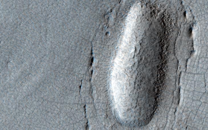
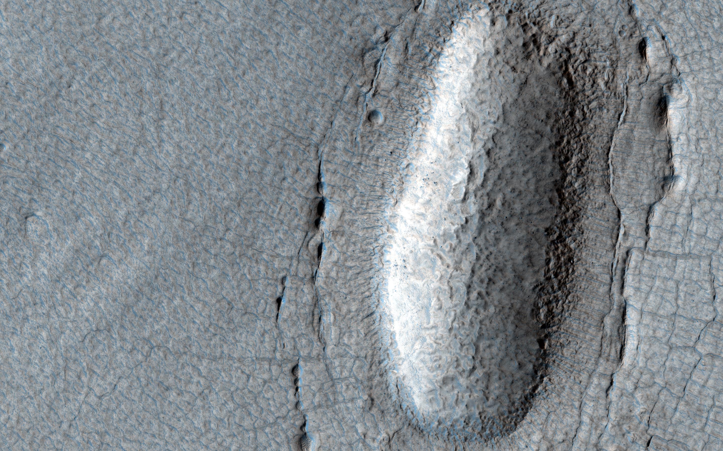
Lines of Pits in Protonilus Mensae
- Click the image above for a larger view
- Full-Res JPEG (2880 x 1800) (1.0 MB)
- Full-Res TIFF (2880 x 1800) (15.6 MB)
Caption:
Map Projected Browse Image
Click on image for larger version
This observation shows a lobe-shaped debris apron emanating from a massif (shown in the upper left of the image) in the Protonilus Mensae region in the Northern Hemisphere of Mars.
These aprons are composed of nearly pure water ice with a layer of debris on the surface protecting the ice from sublimation (going directly from a solid to gaseous state). This image shows different terrain types on the apron that indicate the presence and flow of ice, from smoother polygonal terrain closer to the massif, to rougher, patterned ground commonly called "brain terrain." Also visible on the apron are a series of linear pits. These pits might form from material collapsing into subsurface voids after buried ice has sublimated.
The map is projected here at a scale of 25 centimeters (9.8 inches) per pixel. (The original image scale is 30.1 centimeters [11.9 inches] per pixel [with 1 x 1 binning]; objects on the order of 90 centimeters [35.4 inches] across are resolved.) North is up.
Background Info:
The University of Arizona, in Tucson, operates HiRISE, which was built by Ball Aerospace & Technologies Corp., in Boulder, Colorado. NASA's Jet Propulsion Laboratory, a division of Caltech in Pasadena, California, manages the Mars Reconnaissance Orbiter Project for NASA's Science Mission Directorate, Washington.
Cataloging Keywords:
| Name | Value | Additional Values |
|---|---|---|
| Target | Mars | |
| System | ||
| Target Type | Planet | |
| Mission | Mars Reconnaissance Orbiter (MRO) | |
| Instrument Host | Mars Reconnaissance Orbiter | |
| Host Type | Orbiter | |
| Instrument | High Resolution Imaging Science Experiment (HiRISE) | |
| Detector | ||
| Extra Keywords | Color, Map, Water | |
| Acquisition Date | ||
| Release Date | 2021-12-20 | |
| Date in Caption | ||
| Image Credit | NASA/JPL-Caltech/University of Arizona | |
| Source | photojournal.jpl.nasa.gov/catalog/PIA25084 | |
| Identifier | PIA25084 | |