|
A Greenwich Observatory on Mars
- Click the image above for a larger view
- Full-Res JPEG (2880 x 1800) (812.2 kB)
- Full-Res TIFF (2880 x 1800) (15.6 MB)
Caption:
Map Projected Browse Image
Click on image for larger version
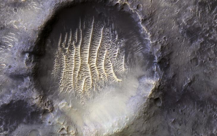
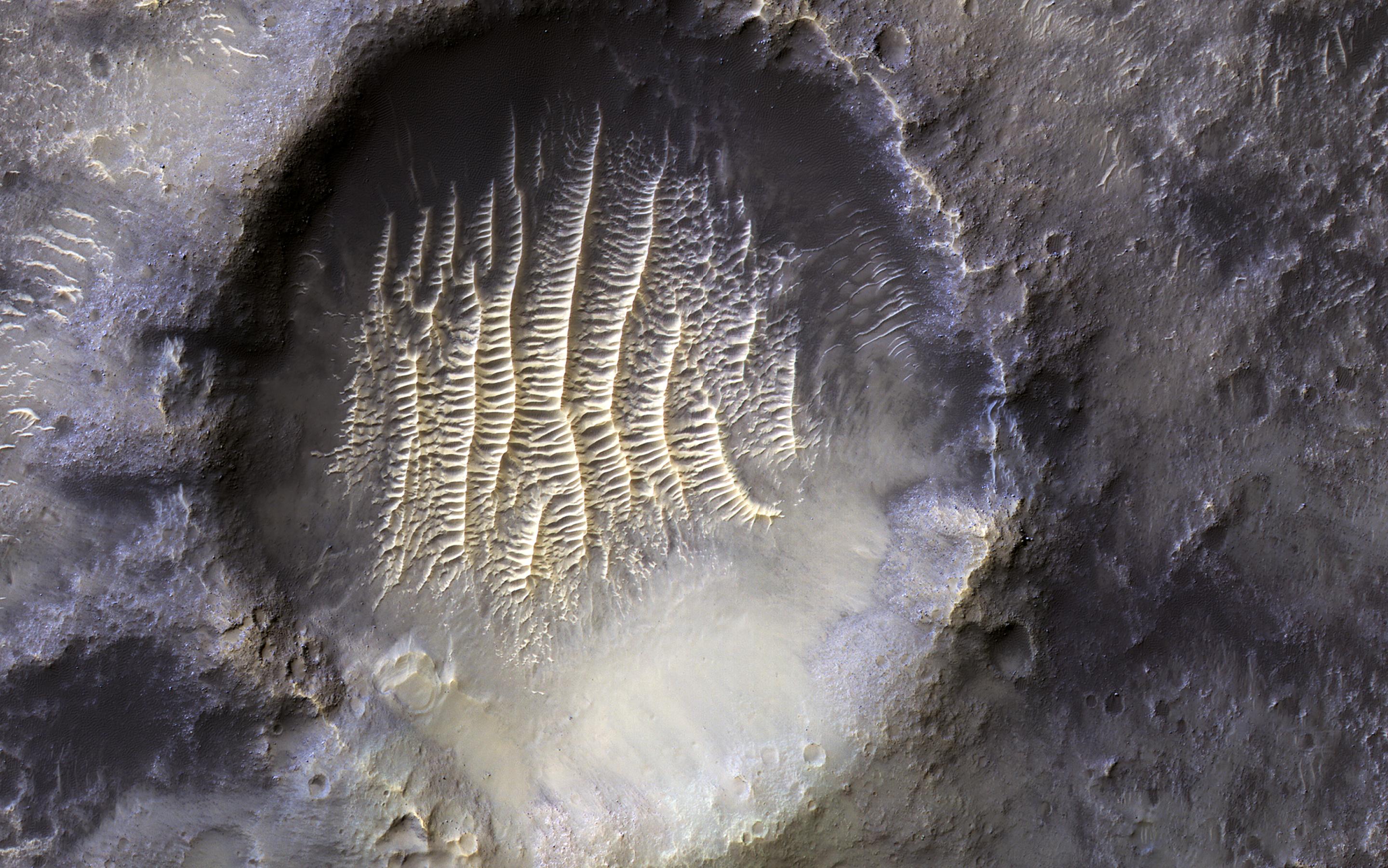
The crater in the center of this HiRISE image defines where zero longitude is on Mars, like the Greenwich Observatory does for the Earth.
Originally, the larger crater that this crater sits within, called Airy Crater, defined zero longitude for the Red Planet. But as higher resolution images became available, a smaller feature was needed. This crater, called Airy-0 (zero), was selected because it would require no adjustment of existing maps.
These days, longitude on Mars is measured even more precisely using radio tracking of landers such as InSight, but everything is still defined to keep zero longitude centered on this crater.
The map is projected here at a scale of 50 centimeters (19.7 inches) per pixel. (The original image scale is 59.1 centimeters [23.3 inches] per pixel [with 2 x 2 binning]; objects on the order of 177 centimeters [69.7 inches] across are resolved.) North is up.
This is a stereo pair with ESP_070869_1750 .
Background Info:
The University of Arizona, in Tucson, operates HiRISE, which was built by Ball Aerospace & Technologies Corp., in Boulder, Colorado. NASA's Jet Propulsion Laboratory, a division of Caltech in Pasadena, California, manages the Mars Reconnaissance Orbiter Project for NASA's Science Mission Directorate, Washington.
Cataloging Keywords:
| Name | Value | Additional Values |
|---|---|---|
| Target | Mars | |
| System | ||
| Target Type | Planet | |
| Mission | Mars Reconnaissance Orbiter (MRO) | InSight |
| Instrument Host | Mars Reconnaissance Orbiter | InSight Lander |
| Host Type | Orbiter | Lander |
| Instrument | High Resolution Imaging Science Experiment (HiRISE) | |
| Detector | ||
| Extra Keywords | Crater, Map, Radio | |
| Acquisition Date | ||
| Release Date | 2022-01-21 | |
| Date in Caption | ||
| Image Credit | NASA/JPL-Caltech/University of Arizona | |
| Source | photojournal.jpl.nasa.gov/catalog/PIA25090 | |
| Identifier | PIA25090 | |