|
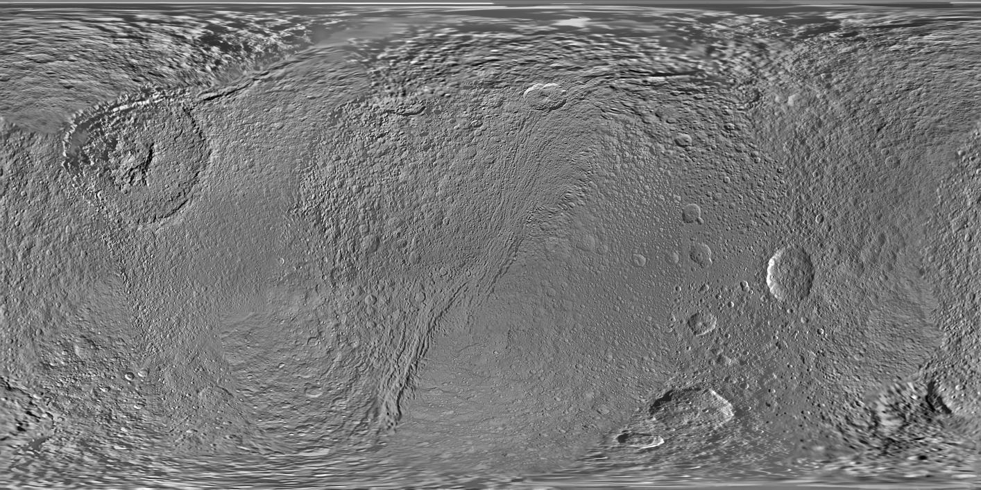
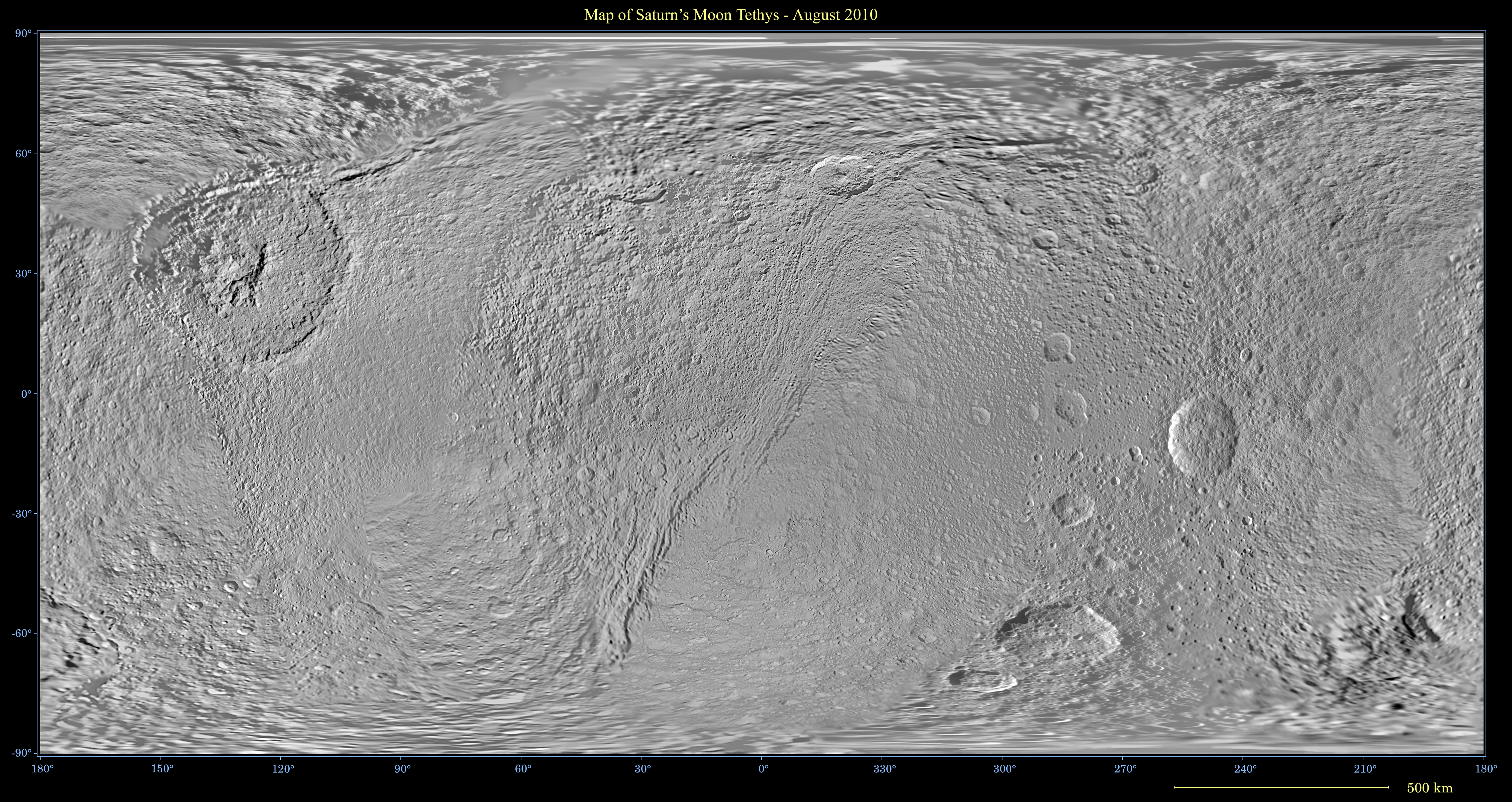
Map of Tethys - August 2010
- Click the image above for a larger view
- Full-Res JPEG (11520 x 5760) (6.9 MB)
- Full-Res TIFF (11520 x 5760) (66.4 MB)
Caption:
Click on the image for larger annotated version
This global map of Saturn's moon Tethys was created using images taken by NASA's Cassini spacecraft.
This map is an update to the version released in February 2010 (see PIA12560 ). New data collected during Cassini's Aug. 14, 2010, flyby of the moon are used to fill in the far northern latitudes of the map from about 75 degrees north latitude to the north pole. Coverage also improves farther south on the side of the moon facing away from Saturn. That improved coverage starts at about 40 degrees north latitude and stretches north to the pole in the area roughly west of the large Odysseus Crater (between 160 degrees and 260 degrees west longitude).
The map is an equidistant (simple cylindrical) projection and has a scale of 293 meters (960 feet) per pixel at the equator in the full size version. The mean radius of Tethys used for projection of this map is 536.3 kilometers (333.2 miles). The resolution of the map is 32 pixels per degree.
Background Info:
The Cassini-Huygens mission is a cooperative project of NASA, the European Space Agency and the Italian Space Agency. The Jet Propulsion Laboratory, a division of the California Institute of Technology in Pasadena, manages the mission for NASA's Science Mission Directorate in Washington. The Cassini orbiter and its two onboard cameras were designed, developed and assembled at JPL. The imaging team is based at the Space Science Institute, Boulder, Colo.
For more information about the Cassini-Huygens mission visit http://saturn.jpl.nasa.gov/ . The Cassini imaging team homepage is at http://ciclops.org .
Cataloging Keywords:
| Name | Value | Additional Values |
|---|---|---|
| Target | Tethys | Saturn |
| System | Saturn | |
| Target Type | Satellite | Planet |
| Mission | Cassini-Huygens | |
| Instrument Host | Cassini Orbiter | |
| Host Type | Orbiter | |
| Instrument | Imaging Science Subsystem (ISS) | |
| Detector | ||
| Extra Keywords | Crater, Grayscale, Map | |
| Acquisition Date | ||
| Release Date | 2010-11-30 | |
| Date in Caption | 2010-08-14 | |
| Image Credit | NASA/JPL/Space Science Institute | |
| Source | photojournal.jpl.nasa.gov/catalog/PIA11673 | |
| Identifier | PIA11673 | |