|
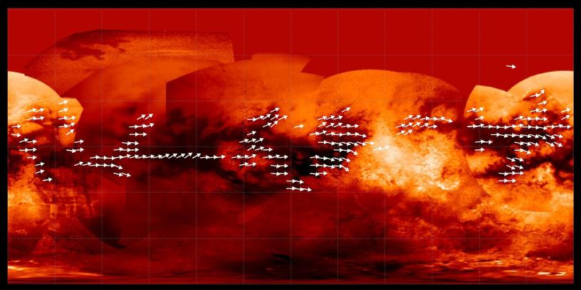
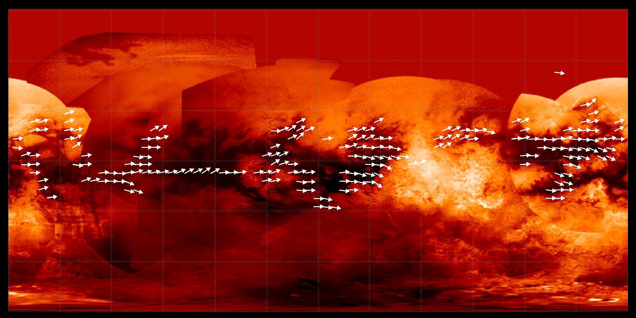
Mapping Titan’s Global Wind Patterns
- Click the image above for a larger view
- Full-Res JPEG (2048 x 1024) (282.2 kB)
- Full-Res TIFF (2048 x 1024) (6.3 MB)
Caption:
Scientists have used data from the Cassini radar mapper to map the global wind pattern on Saturn's moon Titan using data collected over a four-year period, as depicted in this image.
The arrows indicate the direction in which sand is inferred to be transported along dunes observed in Titan radar data. Underlying the arrows is a base map (see PIA08399 ) from Cassini's imaging science subsystem. Many of the equatorial dark areas without arrows might have dunes but have not yet been imaged with radar. The dune orientations represent only the net effect of winds. It could be that sand transport only occurs on rare occasions, and winds from different directions can combine to yield the observed dune orientations.
Background Info:
The Cassini-Huygens mission is a cooperative project of NASA, the European Space Agency and the Italian Space Agency. The Jet Propulsion Laboratory, a division of the California Institute of Technology in Pasadena, manages the mission for NASA's Science Mission Directorate, Washington, D.C. The Cassini orbiter and its two onboard cameras were designed, developed and assembled at JPL. The imaging operations center is based at the Space Science Institute in Boulder, Colo.
For more information about the Cassini-Huygens mission visit http://saturn.jpl.nasa.gov/ . The Cassini imaging team homepage is at http://ciclops.org .
Cataloging Keywords:
| Name | Value | Additional Values |
|---|---|---|
| Target | Titan | |
| System | Saturn | |
| Target Type | Satellite | |
| Mission | Cassini-Huygens | |
| Instrument Host | Cassini Orbiter | |
| Host Type | Orbiter | |
| Instrument | Radar Mapper | |
| Detector | ||
| Extra Keywords | Color, Dune, Map, Radar | |
| Acquisition Date | ||
| Release Date | 2009-02-26 | |
| Date in Caption | ||
| Image Credit | NASA/JPL-Caltech/ASI/Space Science Institute | |
| Source | photojournal.jpl.nasa.gov/catalog/PIA11801 | |
| Identifier | PIA11801 | |