
|
Scanning Enceladus’ Surface
- Click the image above for a larger view
- Full-Res JPEG (1016 x 1016) (230.4 kB)
- Full-Res TIFF (1016 x 1016) (1.0 MB)
Caption:
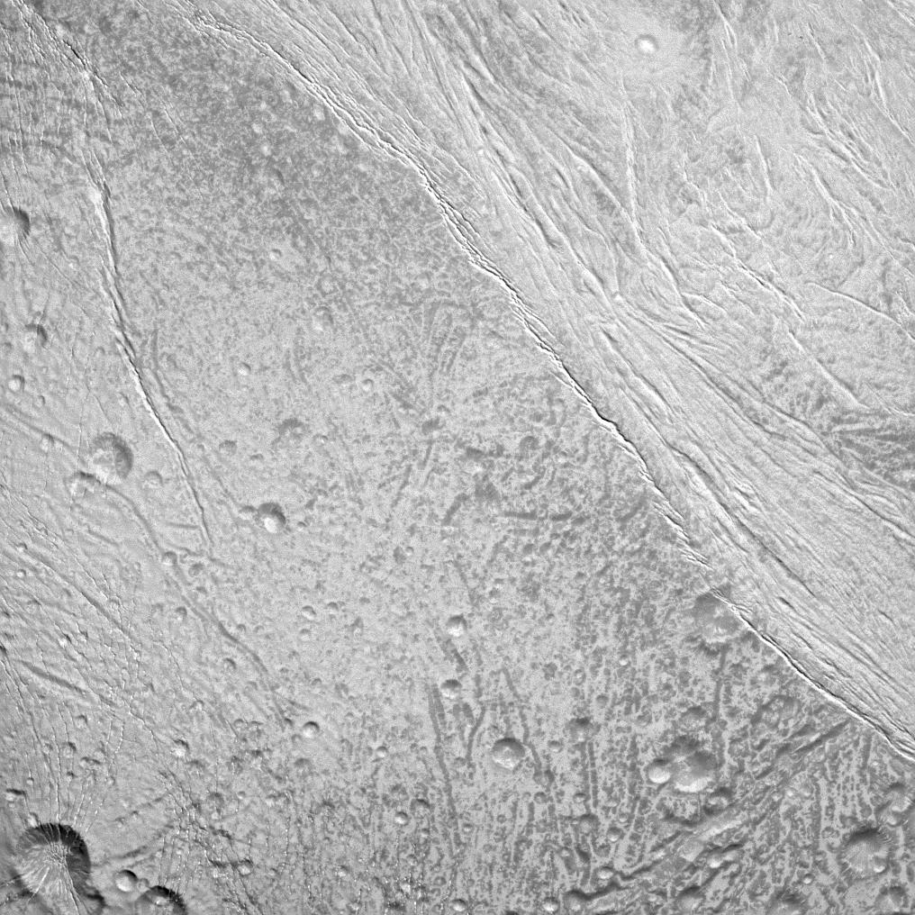
The Cassini spacecraft surveys the surface of Saturn's moon Enceladus in this image, which shows newly created terrain in the upper right meeting older, cratered terrain in the lower left.
This view is centered on terrain at 5 degrees south latitude, 200 degrees west longitude. For a closer view of the surface of Enceladus (504 kilometers, or 313 miles across), see PIA11685 .
The image was taken in visible light with the Cassini spacecraft narrow-angle camera on Dec. 21, 2010. The view was acquired at a distance of approximately 25,000 kilometers (15,000 miles) from Enceladus and at a Sun-Enceladus-spacecraft, or phase, angle of 14 degrees. Image scale is 148 meters (486 feet) per pixel.
Background Info:
The Cassini-Huygens mission is a cooperative project of NASA, the European Space Agency and the Italian Space Agency. The Jet Propulsion Laboratory, a division of the California Institute of Technology in Pasadena, manages the mission for NASA's Science Mission Directorate, Washington, D.C. The Cassini orbiter and its two onboard cameras were designed, developed and assembled at JPL. The imaging operations center is based at the Space Science Institute in Boulder, Colo.
For more information about the Cassini-Huygens mission visit http://saturn.jpl.nasa.gov/ . The Cassini imaging team homepage is at http://ciclops.org .
Cataloging Keywords:
| Name | Value | Additional Values |
|---|---|---|
| Target | Enceladus | |
| System | Saturn | |
| Target Type | Satellite | |
| Mission | Cassini-Huygens | |
| Instrument Host | Cassini Orbiter | |
| Host Type | Orbiter | |
| Instrument | Imaging Science Subsystem (ISS) | |
| Detector | Narrow Angle Camera | |
| Extra Keywords | Crater, Grayscale, Visual | |
| Acquisition Date | ||
| Release Date | 2011-05-09 | |
| Date in Caption | 2010-12-21 | |
| Image Credit | NASA/JPL/Space Science Institute | |
| Source | photojournal.jpl.nasa.gov/catalog/PIA12765 | |
| Identifier | PIA12765 | |