|
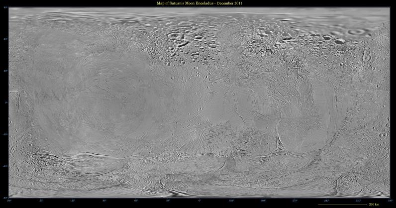
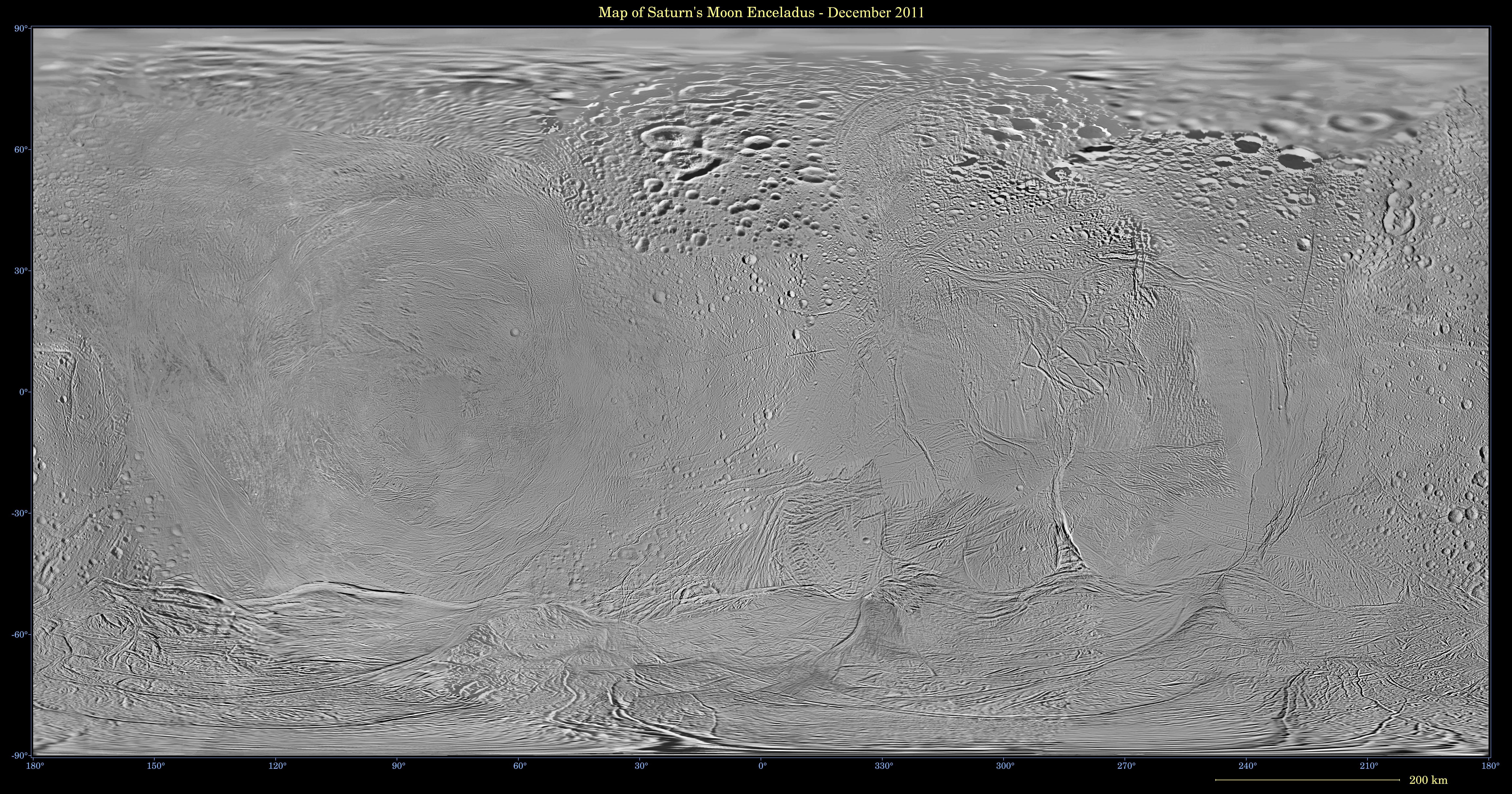
Map of Enceladus - December 2011
- Click the image above for a larger view
- Full-Res JPEG (7480 x 3930) (5.0 MB)
- Full-Res TIFF (7480 x 3930) (88.2 MB)
Caption:
This mosaic shows an updated global map of Saturn's icy moon Enceladus, created using images taken during Cassini spacecraft flybys. The map incorporates new images taken during flybys in December 2011.
This map is an update to the version released in February 2010 (see PIA12564 ). Like other recent Enceladus global maps, this mosaic was shifted by 3.5 degrees to the west, compared to 2006 versions, to be consistent with the International Astronomical Union longitude definition for Enceladus.
The so-called "tiger stripe" features that have captivated Cassini scientists can be seen distorted by the projection method in the lower middle left and lower middle right of the image.
The map is an equidistant (simple cylindrical) projection and has a scale of 360 feet (110 meters) per pixel at the equator. The mean radius of Enceladus used for projection of this map is 157 miles (252 kilometers).
Photojournal Note : Also available is the full resolution TIFF . This file may be too large to view from a browser; it can be downloaded onto your desktop by right-clicking on the previous link and viewed with image viewing software.
Background Info:
The Cassini-Huygens mission is a cooperative project of NASA, the European Space Agency and the Italian Space Agency. The Jet Propulsion Laboratory, a division of the California Institute of Technology in Pasadena, manages the mission for NASA's Science Mission Directorate, Washington, D.C. The Cassini orbiter and its two onboard cameras were designed, developed and assembled at JPL. The imaging operations center is based at the Space Science Institute in Boulder, Colo.
For more information about the Cassini-Huygens mission visit http://saturn.jpl.nasa.gov . The Cassini imaging team homepage is at http://ciclops.org .
Cataloging Keywords:
| Name | Value | Additional Values |
|---|---|---|
| Target | Enceladus | |
| System | Saturn | |
| Target Type | Satellite | |
| Mission | Cassini-Huygens | |
| Instrument Host | Cassini Orbiter | |
| Host Type | Orbiter | |
| Instrument | Imaging Science Subsystem (ISS) | |
| Detector | ||
| Extra Keywords | Color, Map | |
| Acquisition Date | ||
| Release Date | 2013-04-11 | |
| Date in Caption | ||
| Image Credit | NASA/JPL-Caltech/Space Science Institute | |
| Source | photojournal.jpl.nasa.gov/catalog/PIA14937 | |
| Identifier | PIA14937 | |